
Meigs County
Reedsville, Ohio
Rock Run Pole Bldg at Ohio River Retreat
5.464 acres
$99,900
Land and Cabin
Ohio River Retreat

Ohio land by county
Compare Countrytyme land around Langsville, Reedsville, Vinton and the Albany mailing area, from wooded recreational acreage to potential country homesites. Listing maps, surveys, documents and GPS directions help you plan the property visit; Forked Run, forest trails and the lively Pomeroy riverfront make it easy to plan the rest of your day.
Available now


Local land guide
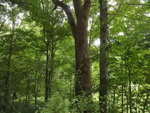
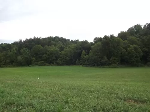
The moment the Ohio River comes into view in Meigs County, it is difficult not to smile. The water curves below steep, leafy hills, with little river towns tucked along the bank and country roads wandering west through farms and forest. Countrytyme properties are spread around Langsville, Reedsville, Vinton and the Albany mailing area, so a day of property tours becomes a genuine tour of the county. Each part feels a little different. Watch how the ridges soften, how the views open up and how the trip to town changes from one tract to another.
While you are here, Forked Run State Park is the place we would happily build a whole afternoon around. The park's 102-acre lake is open for boating, paddling and fishing, and there are hiking trails, campsites, cabins, picnic areas and a designated swimming beach. It works whether you want a real outdoor adventure or simply somewhere pretty to eat lunch by the water. If you prefer your nature quieter and wilder, Shade River State Forest offers hiking, wildlife watching and public hunting under current rules. Facilities are limited, especially in the western tract, so this is the place for people who enjoy a more backcountry feel.
For a gentler leg-stretcher, the Meigs SWCD Conservation Area has an approximately 1.5-mile loop through wetland, meadow and wildlife habitat. History lovers can head toward Portland and the Buffington Island Battlefield Memorial Park, where the Ohio History Connection interprets the Civil War battle fought in this river corridor.
Then there is Pomeroy. We really love the simple pleasure of walking along the river, browsing downtown and watching boats move through the big bend. The county visitor guide describes a four-mile riverwalk, so there is plenty of room to stretch your legs. Make River Roasters Coffee Company part of the outing. Its riverfront setting is lovely, and the menu goes well beyond coffee with quiche, sandwiches, soup, cheesecake and locally famous oatmeal cream pies. For a classic hometown breakfast or lunch, The Court Grill is another easy choice near the courthouse and river.
Pomeroy's riverfront is at its happiest when the community fills it with music and market tents. The seasonal Meigs County Farmers' Market brings local produce, baked goods and handmade items to the levee. The Big Bend Blues Bash turns downtown into a summer music party, while the Sternwheel Riverfest celebrates the boats and river culture that give the town so much character. The Meigs County Fair rounds out the year with the livestock, food, exhibits and entertainment everyone hopes to find at a true county fair.
When you are ready to walk a property, use the listing's GPS coordinates; a new rural street address may not cooperate with every navigation app. Let Countrytyme's interactive map show your position on the tract, and review the survey, deeded access, easements, utilities, restrictions and available documents. Afterward, take the river road home. In Meigs County, one more bend can lead to the best view of the day.
More information:
• 2026 Meigs County visitor guide — https://meigsohio.com/guide/
• Meigs County places to play, shop and explore — https://meigsohio.com/cvb/things-to-do/
• Current Meigs County events calendar — https://meigsohio.com/events/
• Forked Run State Park map — https://dam.assets.ohio.gov/image/upload/ohiodnr.gov/documents/parks/parkmaps/forkedrunparkmap.pdf
• Meigs County dining guide — https://meigsohio.com/cvb/dine/
A clearer property search
New rural addresses do not always appear correctly in online maps. Countrytyme listings use the tract's GPS location for directions. When a property-line map is available, open it on your phone and follow your location while walking the acreage.
Buyer questions
Countrytyme's live page shows current properties near Langsville, Reedsville, Vinton and the Albany mailing area. Depending on inventory, buyers may find wooded recreation land, potential homesites, larger acreage and tracts with creeks, ponds or river-country views.
Forked Run State Park is the all-around favorite because a single visit can include hiking, fishing, paddling, a picnic or a swim at the designated beach.
Forked Run Lake supports boating and paddling under current park rules. Identified ramps also reach the Ohio River, but its current, commercial traffic and changing conditions require more experience and preparation than a small lake.
Walk the riverfront, then visit River Roasters for coffee, lunch or one of its oatmeal cream pies. Check the Meigs County events calendar before you go; the levee frequently hosts markets, music and community celebrations.
• Southern Ohio Recreation Area — 4,015 total acres across Meigs and Gallia counties — https://www.aep.com/recreation/areas/southernohio/
• Shade River State Forest — 2,859 acres — https://dam.assets.ohio.gov/image/upload/odnr/forestry/Maps/shaderiver.pdf
• Forked Run State Park — 964.96 property acres; 102-acre lake — https://dam.assets.ohio.gov/image/upload/ohiodnr.gov/documents/parks/parkmaps/forkedrunparkmap.pdf
• Ohio River Access – Forked Run Wildlife Area — 34.14 acres — https://dam.assets.ohio.gov/image/upload/ohiodnr.gov/documents/parks/parkmaps/forkedrunhuntingmap.pdf
• Ohio River Access – Old Town Creek — 33.31 acres — https://codes.ohio.gov/ohio-administrative-code/rule-1501%3A31-15-04
• Ohio River Access – Racine (Horace W. Karr Ohio River Access) — 21.06 acres — https://codes.ohio.gov/ohio-administrative-code/rule-1501%3A31-15-04
• Ohio River Access – Shade River — 29.21 acres — https://codes.ohio.gov/ohio-administrative-code/rule-1501%3A31-15-04
• Ohio River Lock and Dam 21 Wildlife Area — 15.18 acres — https://codes.ohio.gov/ohio-administrative-code/rule-1501%3A31-15-04
• Ohio River Lock and Dam 23 Wildlife Area — 12.03 acres — https://codes.ohio.gov/ohio-administrative-code/rule-1501%3A31-15-04
Local track record
 Sold
Sold
 Sold
Sold
 Sold
Sold
 Sold
Sold
 Sold
Sold
 Sold
Sold
More current Ohio land